
Mount Sabyinyo, the legendary Volcano of three countries is one of the most dramatic and rewarding volcanoes to hike in East Africa. Rising sharply along the borders of Uganda, Rwanda, and the Democratic Republic of Congo, this extinct volcano is part of the Virunga Mountain Range and offers adventurous travelers a rare opportunity to stand in three countries at once. Known for its rugged terrain, knife-edge ridges, and breathtaking views, Mount Sabyinyo is a bucket-list destination for hikers seeking challenge, scenery, and history.
Where Is Mount Sabyinyo Located?
Mount Sabyinyo is located in southwestern Uganda, at the edge of Mgahinga Gorilla National Park, and forms a natural boundary with Volcanoes National Park in Rwanda and Virunga National Park in DR Congo. The mountain reaches an elevation of approximately 3,669 meters (12,037 feet) above sea level, making it one of the tallest volcanoes in the Virunga chain.
The name Sabyinyo comes from a local word meaning “Old Man’s Teeth,” a reference to the mountain’s deeply eroded, jagged peaks that resemble broken teeth.
Why Hike Mount Sabyinyo?
Hiking Mount Sabyinyo is not just about reaching a summit, it is about the experience. The trail is known for being steep, technical, and adventurous, making it ideal for experienced hikers or physically fit travelers looking for a challenge.
Unique Highlights of Mount Sabyinyo
- Stand in Uganda, Rwanda, and DR Congo simultaneously
- Navigate wooden ladders, bridges, and steep ridges
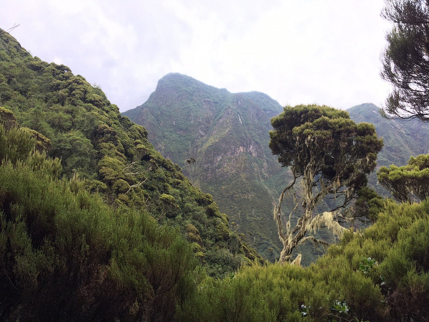
- Enjoy panoramic views of the Virunga Volcanoes
- Hike through bamboo forests, montane vegetation, and alpine zones
- Experience one of the most challenging volcano hikes in the region
Mount Sabyinyo Hiking Experience
Starting Point and Duration
The Mount Sabyinyo hike starts at Ntebeko head quarters of Mgahinga Gorilla National Park. After a ranger briefing, hikers set off early in the morning.
- Hiking duration: 6–8 hours (round trip)
- Difficulty level: Challenging
- Distance: Approximately 14 km round trip
- Altitude gain: Significant and continuous
Trail Description
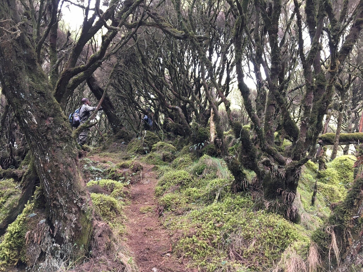 The trail ascends rapidly through dense forest and bamboo zones before reaching exposed ridges. Several sections require climbing wooden ladders and crossing narrow bridges over deep ravines. As altitude increases, vegetation thins, revealing dramatic volcanic landscapes. The final ascent to the summit is steep but rewarding. At the top, hikers reach a triple-border marker, where Uganda, Rwanda, and DR Congo meet.
Wildlife and Nature Along the Trail
Mount Sabyinyo lies within a protected ecosystem and offers excellent opportunities for nature lovers. The Wildlife You May Encounter on your hike to Mount Sabyinyo include golden monkeys, forest elephants (rare but possible), bushbucks and numerous bird species, including Albertine Rift endemics. The mountain’s diverse habitats support rich biodiversity, making the hike as much a nature experience as a physical challenge.
Best Time to Hike Mount Sabyinyo
Mount Sabyinyo can be hiked throughout the year, but weather conditions significantly affect trail safety and visibility. The Best Hiking Seasons is June to September and December to February which is a dry season and best hiking conditions.
What to Pack for Mount Sabyinyo Hike
Proper preparation is essential for a safe and enjoyable hike.
Essential Hiking Gear
- Sturdy hiking boots with good grip
- Waterproof jacket and warm layers
- Hiking gloves (for ladders and ropes)
- Walking stick (provided at the park)
- Packed lunch and energy snacks
- At least 2–3 liters of drinking water
- Camera or smartphone for photos
Hiring a porter is highly recommended, especially for steep sections.
Mount Sabyinyo Hiking Permits and Fees
Hiking Mount Sabyinyo requires a permit issued by Uganda Wildlife Authority (UWA). The Permit costs USD 85 per person including ranger guide and park entry. Hikers are also advised to hire porters at a small fee. You are reminded that hiking permits should be booked in advance, especially during peak travel seasons.
How to Get to Mount Sabyinyo
From Kampala or Entebbe
- Drive time: 8–9 hours
- Route: Kampala – Kabale – Kisoro – Mgahinga Gorilla National Park
From Kigali, Rwanda
- Drive time: 4–5 hours
- Border crossing via Cyanika
- Ideal for travelers combining Rwanda and Uganda safaris
Roads to Kisoro are generally good, though the final stretch is mountainous and winding.
Combining Mount Sabyinyo with Other Activities
Mount Sabyinyo is often combined with other experiences in Mgahinga and the surrounding region. Popular addons include gorilla trekking in Mgahinga or Bwindi, golden monkey tracking, Batwa cultural experience, other volcano hikes (Mount Gahinga or Mount Muhabura) and Lake Mutanda or Lake Mulehe excursions
Is Mount Sabyinyo Worth Hiking?
For adventurous travelers, Mount Sabyinyo is worth it. It offers one of the most unique hiking experiences in Africa, combining physical challenge, stunning scenery, and the rare thrill of standing in three countries at once. While demanding, the sense of achievement at the summit is unmatched. If you are planning a safari or adventure holiday in Uganda, Mount Sabyinyo deserves a place high on your itinerary.
1 Day Mount Sabyinyo Hiking Itinerary
 Your 1 Day Mount Sabyinyo Hiking Guide begins with an early morning transfer to Ntebeko Visitor Centre, the main starting point for all hikes in Mgahinga Gorilla National Park. Arrival is usually between 7:00–8:00 am. Upon arrival, register and attend a mandatory briefing by Uganda Wildlife Authority rangers, covering safety guidelines, trail conditions, and expectations for the day.
At 8:0am, start the hike ascending steadily through montane forest with lush vegetation, Bamboo forest, home to golden monkeys and sub-alpine vegetation with open views. As you gain altitude, the terrain becomes steeper and more technical. Wooden ladders and narrow ridges are used to navigate deep ravines and sharp slopes. After approximately 3–4 hours, you will reach the summit ridge. The final ascent is steep but rewarding.
Arrive at a triple-border point where Uganda, Rwanda, and DR Congo meet. This is the highlight of the 1 Day Mount Sabyinyo Hiking Guide, offering panoramic views of the Virunga Volcanoes and excellent photo opportunities. Have a short rest and enjoy your packed at the summit before beginning the descent.
In the afternoon, descending following the same trail back to Ntebeko. While downhill, care is required on ladders and muddy sections, especially during wet seasons. Expect the descent to take 2–3 hours, with occasional stops to rest and enjoy the scenery. The hike concludes at Ntebeko Visitor Centre in the late afternoon, usually between 3:00–5:00 pm. This marks the end of your 1 Day Mount Sabyinyo Hiking Guide experience. From here, travelers return to their lodge in Kisoro, Lake Mutanda, or continue onward to their next destination.
How to book Mount Sabyinyo hiking tour
Contact Superfine Safaris limited for a customized 1 Day or 2 Days Mount Sabyinyo hiking tour. We help you make an organized pocket friendly tour to hike Mount Sabyinyo, help you reserve the permits, transport and accommodation at affordable rates